vessel Al Mayeda IMO: 9397298, Lng Tanker
vesseltracker.com
Vessel Al Mayeda IMO: 9397298, Lng Tanker
MMSI: 538003356 callsign: V7QG4 size: 52x345

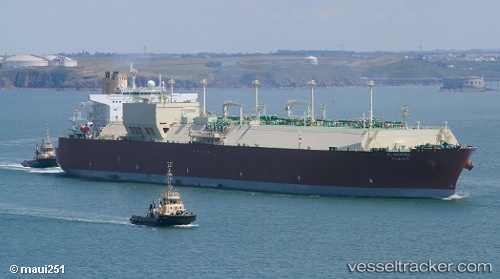
Find the position of the vessel Al Mayeda on the map. The latter are known coordinates and path.

marine traffic ship tracker show on live map

The current position of vessel Al Mayeda is 24.6291 lat / 122.596 lng. Updated: 2025-05-09 10:31:22 UTC
Port of registry:
Majuro (capital of the Marshall Islands)
Payload_mass:
130298 tonne
Gross tonnage:
163922
Service entry:
2009-01-01T00:00:00Z

Manufacturer:
Samsung Heavy Industries (South Korean shipbuilding company)
Details:


Last coordinates of the vessel:
UTC, 26.148, 122.777, course: 178, speed: 15.1
UTC, 24.6576, 122.603, course: 194, speed: 12.1
2025-05-09 10:31:22 UTC, 24.6291, 122.596, course: 192, speed: 12.2

Track of the vessel in the last 14 days


The ship also appears on the maps:


Most frequent ports a vessels calls at Al Mayeda (538003356):

Sambu, traffic: 35
Singapore, traffic: 24
PULAU SAMBU, traffic: 7
PENGERANG, traffic: 6
Mutrah, traffic: 6
BATU AMPAR, traffic: 5
Bur Ibrahim, traffic: 5
BUKOM ISLAND, traffic: 4
RAS LAFFAN, traffic: 4
Algeciras, traffic: 4
TANAH MERAH, traffic: 4
Strait Of Gibraltar, traffic: 2
Milford Haven, traffic: 2
Port Said, traffic: 2
Ra’S Shukhayr, traffic: 2

Link to the map:


Find another ship

Al_Mayeda (538003356) last ports (portcalls and passsages)

PENGERANG | 2025-04-30 12:51:52
BATU AMPAR | 2025-04-30 11:49:12
PULAU SAMBU | 2025-04-30 11:24:42
RAS LAFFAN | 2025-04-18 20:33:53
BUKOM ISLAND | 2025-03-29 02:54:46
Sambu | 2025-03-29 01:52:00
BATU AMPAR | 2025-03-29 00:33:52
TANAH MERAH | 2025-03-28 23:32:14
PENGERANG | 2025-03-28 22:31:28
BATU AMPAR | 2025-03-11 19:39:41
PULAU SAMBU | 2025-03-11 18:45:01
RAS LAFFAN | 2025-02-27 19:24:07
Sambu | 2025-02-17 14:55:00
TANAH MERAH | 2025-02-17 13:39:41
PENGERANG | 2025-02-17 12:26:58
BATU AMPAR | 2025-01-29 21:49:50
RAS LAFFAN | 2025-01-18 07:08:36
BUKOM ISLAND | 2025-01-06 15:09:10
PULAU SAMBU | 2025-01-06 13:06:36
TANAH MERAH | 2025-01-06 11:55:03
PENGERANG | 2025-01-06 11:13:30
PENGERANG | 2024-12-17 08:14:51
BATU AMPAR | 2024-12-17 07:23:51
SULTAN QABOOS | 2024-12-08 06:23:54
RAS LAFFAN | 2024-12-05 17:11:40
BUKOM ISLAND | 2024-11-22 05:55:11
Sambu | 2024-11-22 04:59:51
TANAH MERAH | 2024-11-22 04:09:18
PENGERANG | 2024-11-22 03:00:46
Sambu | 2024-10-31 05:52:47
Sambu | 2024-10-07 08:49:49
Sambu | 2024-09-18 18:56:10
Mutrah | 2024-09-10 04:25:24
Algeciras | 2024-08-05 23:39:50
Port St. Louis Du Rhone | 2024-08-02 06:39:05
Singapore | 2024-06-14 06:11:22
Singapore | 2024-05-23 04:31:05
Singapore | 2024-04-29 08:28:57
Singapore | 2024-04-13 03:41:28
Sambu | 2024-01-15 04:12:23
Singapore | 2023-12-24 09:11:07
Singapore | 2023-12-02 10:32:24
Sambu | 2023-10-10 00:20:12
Mutrah | 2023-09-12 19:41:26
Fateh Terminal | 2023-09-09 18:02:43
Sambu | 2023-08-30 20:39:22
Singapore | 2023-07-23 12:54:48
Singapore | 2023-07-08 06:47:50
Mutrah | 2023-06-19 04:56:01
Singapore | 2023-06-09 10:21:23
Sambu | 2023-06-09 09:43:34
Sambu | 2023-05-24 06:14:16
Singapore | 2023-05-03 01:07:37
Singapore | 2023-03-25 05:42:39
Mutrah | 2022-12-12 08:59:12
Ra’S Shukhayr | 2022-12-02 21:00:26
Bur Ibrahim | 2022-12-02 14:22:42
Algeciras | 2022-11-26 14:48:59
Zeebrugge | 2022-11-21 08:24:46
Strait Of Gibraltar | 2022-11-17 05:25:53
Singapore | 2022-08-20 04:42:49
Bur Ibrahim | 2022-08-01 14:08:56
Port Said | 2022-08-01 04:19:20
Algeciras | 2022-07-25 07:10:36
Milford Haven | 2022-07-21 04:27:38
Strait Of Gibraltar | 2022-07-18 08:09:47
Cartagena | 2022-07-15 19:54:37
Bur Ibrahim | 2022-07-08 04:45:53
Ras Gharib | 2022-06-20 20:01:25
Bur Ibrahim | 2022-06-20 13:54:34
Port Said | 2022-06-20 04:33:32
Algeciras | 2022-06-13 16:23:07
Milford Haven | 2022-06-09 10:02:38
Bur Ibrahim | 2022-05-30 04:34:47
Ra’S Shukhayr | 2022-05-29 11:06:32
Mutrah | 2022-02-10 02:58:32
Sambu | 2022-01-16 18:35:55
Singapore | 2022-01-16 18:15:37
Singapore | 2021-12-28 22:30:33
Singapore | 2021-12-28 21:45:43
Sambu | 2021-12-28 21:40:32